Geographic Information Systems (GIS)
Cultural Surveys Hawai‘i (CSH) has been a leader in applying Geographic Information Systems (GIS) technology to archaeological investigations in Hawai‘i. Our experience using GIS dates back to the mid 1990s during our involvement with the U.S. Navy’s Kaho‘olawe Island Ordinance Clearance Project. From its onset, this project utilized an integrated GIS system to collect spatial information, track progress, and coordinate between the Navy and its sub-contractors. Sub-meter accurate Global Positioning System (GPS) units were used in the field to record the precise location of archaeological features, artifact finds, and other aspects of the clearance operation. This information was then uploaded into a project-wide database used by all parties working on the clearance effort. Finalized maps and data summary tables were quickly generated for project management and report production.
Since that time, CSH has developed an extensive GIS database containing archaeological site locations, historic maps, aerial photographs, soil survey layers, place names, and historic land use data. When a project is initiated, maps containing the above information are quickly generated and serve as part of the background study. Fieldwork involves mapping trench locations and all archaeologically-significant information using sub-foot accurate GPS units. All GPS data are then layered with the project specific GIS data and final maps are created. CSH has been complimented many times on the quality and thoroughness of its GIS work.
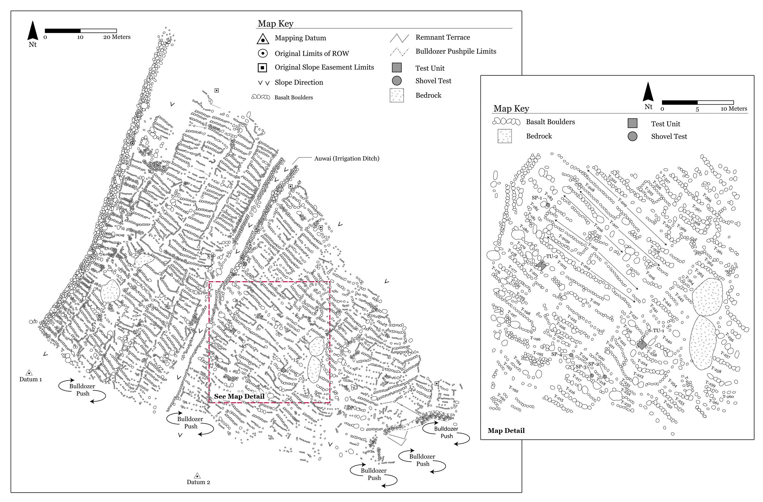
An example of our GIS capabilities can be seen below.